• Home
  • NStew Blog
  • Research Home
  • Buy Prints
  • Photo Gallery
  • Latest Photos
  • Resume
  • About/Portfolio
Menu

Midwest Weather Center

  • Home
  • NStew Blog
  • Research Home
  • Buy Prints
  • Photo Gallery
  • Latest Photos
  • Resume
  • About/Portfolio

Next storm to bring thunderstorms, mild temperatures

January 11, 2023

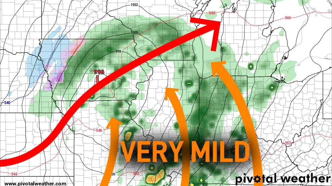
The end of the week and weekend will once again be rather quite across the Midwest, but early next week another storm system will bring a shot of warmer air with highs well into the 50s for portions of the area, as well as a risk for showers and thunderstorms.

Through the weekend, East Coast ridging will bring in southwest flow aloft starting the transition to mild temperatures (especially for January) and allowing more moisture to be pulled across the Mississippi River Valley.

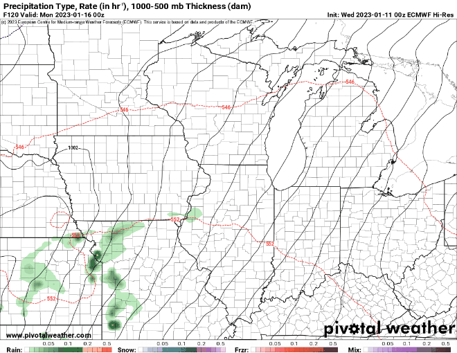
Early Monday morning, showers and a few thunderstorms will develop in the area bringing beneficial rainfall. Given the unseasonably mild temperatures this appears to be mainly a rain event opposed to snow which is obviously more typical this time of year.

The best chance for thunderstorms will be in eastern Missouri and through Illinois, while Iowa and Wisconsin are just locked with showers given less instability to work with.

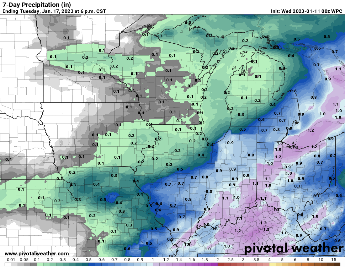
The heaviest precipitation will be found across Missouri, Illinois and Indiana which will be well within the warm sector of this system. Meanwhile, the eastern half of Iowa should see at least a quarter of an inch of precipitation - a number that could be closer to 0.50” is we see some more persistent rains.

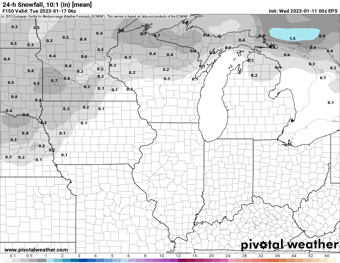
The cold side of the storm system will feature a chance for some light snow, but impactful amounts are unlikely as the bulk of the moisture will be focused farther southeast away from the colder air. With that said, some areas could see around an inch, especially northwest Iowa into Minnesota.

There will be a rather large spread in temperatures across the region with southern Missouri approaching 60°. Much of Iowa and northern Illinois should easily climb into the 40s with Minnesota locked more in the low 30s.

-Nick

Comment

Following a fairly mild start to January for much of the CONUS, there are signs of a colder February brewing.

Long-range signal for colder temperatures to end January

January 08, 2023

January has been off to a fairly mild start but there are signs pointing to a colder end to the month and beginning of February.

850mb temperature anomalies.

Mid January will remain quite mild across the US. The above map shows the lower-level temperature anomalies for January 15. For much of the Midwest and central Plains, temperatures will run 10°-20° above normal which is a big signal for warmth.

Looking at Natural Gas pricing, levels are the lowest in more than a year - a key sign that commodity traders are looking to this verifying. What comes after this warmup though may be a larger cool down heading into February.

NAO forecast - generally negative values are colder signals in the Midwest

The North Atlantic Oscillation had that big dip below zero in early December which was the cold signal around the Christmas holiday. New forecasts for the NAO are trending back towards values below zero which again is a cold signal. There tends to be about a 10-14 day lag in response to central US temperatures.

If this NAO trend continues to dip colder, this could continue to be a continued trend towards a colder February.

AO forecast - generally negative values are colder signals in the Midwest

The AO has already dipped into negative territory and appears to want to stay there. Once again this is a colder signal for the US and could allow for cold-air intrusion across the central US.

Current snowpack

In order to get a really cold blast of air, and colder air to stick, that air needs to be modified by a thick snowpack. While not immense in early January, there is a good fetch of snow from Nebraska through the Dakotas and this could help make any approaching shot of cold air even colder. This is something that was lacking in December ahead of the ‘bomb cyclone’ that approached the region.

Climate Forecast System long-range outlook

While most operational forecast models we use do not go beyond about two weeks, the American CFS does a daily extra-long forecast. This takes us through late January and into February. There remains a signal for a significant blast of cold air to end the month.

The CFS forecast (above) shows a shot of temperatures running 20°-40° below normal by Jan. 28.

Based on the NAO/AO dipping, I think this forecast has legs to stand on, however this remains two-to-three weeks out. At this range, specifics of a forecast are impossible to show, however you can get a sense of changing weather patterns.

We will see how things progress. One headline worth watching is natural gas price futures in the next week. If prices run higher, the confidence in this shot of colder air will be higher as well.

-Nick S.

Comment

Chasing the Winterset, IA EF-4 Wedge Tornado

March 16, 2022
Chasing the Winterset, IA EF-4 Wedge Tornado

Thirteen tornadoes hit the state of Iowa on March 5, 2022. One supercell we chased produced several of those, including an EF-4 traveling just shy of 70 miles.

Read More
Tags: storm chasing, tornado, severe weather
Comment
Viewers can be quite vicious on social media when tornado warning coverage breaks into programming. With all of the hatred on social media, is that a reflection of the viewership during warnings?

Viewers can be quite vicious on social media when tornado warning coverage breaks into programming. With all of the hatred on social media, is that a reflection of the viewership during warnings?

Television ratings during tornado warnings in eastern Iowa

April 01, 2020 in Research

When tornado warnings are issued, broadcast meteorologists are on air warning the public, but how many people tune in and how does it relate to normally scheduled programming?

Read More
Tags: research, tornado, ratings
Comment
Meteorologist Nick Stewart collecting data in a convective snowband near Riverside, Iowa on November 24, 2018.

Meteorologist Nick Stewart collecting data in a convective snowband near Riverside, Iowa on November 24, 2018.

Missing 'The Big One:' Streaks without a big snow storm

February 28, 2020 in Iowa Climatology, winter

Big snowstorms have been hard to come by in eastern Iowa with a historically long stretch without such a winter storm.

Read More
Tags: winter, weather, climatology
1 Comment
Newer / Older
Back to Top